After learning QGIS I wanted to have a better understanding of the PIN Code system in India. This curiosity comes from a small project I started a while back; whenever I will be out of my home town I will send a postcard to my family.
There are more than 1.5 lakh post offices in India and multiple post offices have the same Pin Code; the number of unique Pin Codes is 19,100 (as given on data.gov.in)
Process
• Finding geospatial data of all the Pincodes of India (taken from data.gov.on and from data meet; the geospatial data was scrapped from the Bhuvan app by Devdatta T)
• Mapping them in QGIS
• Finally styling the output in Illustrator
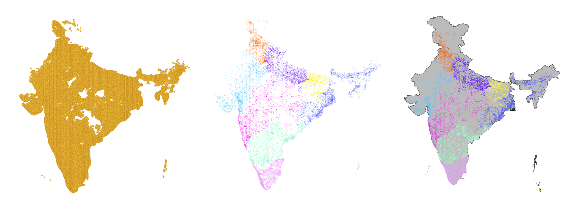
All Pincodes, Unique Pincodes and QGIS Export before styling
Final Poster