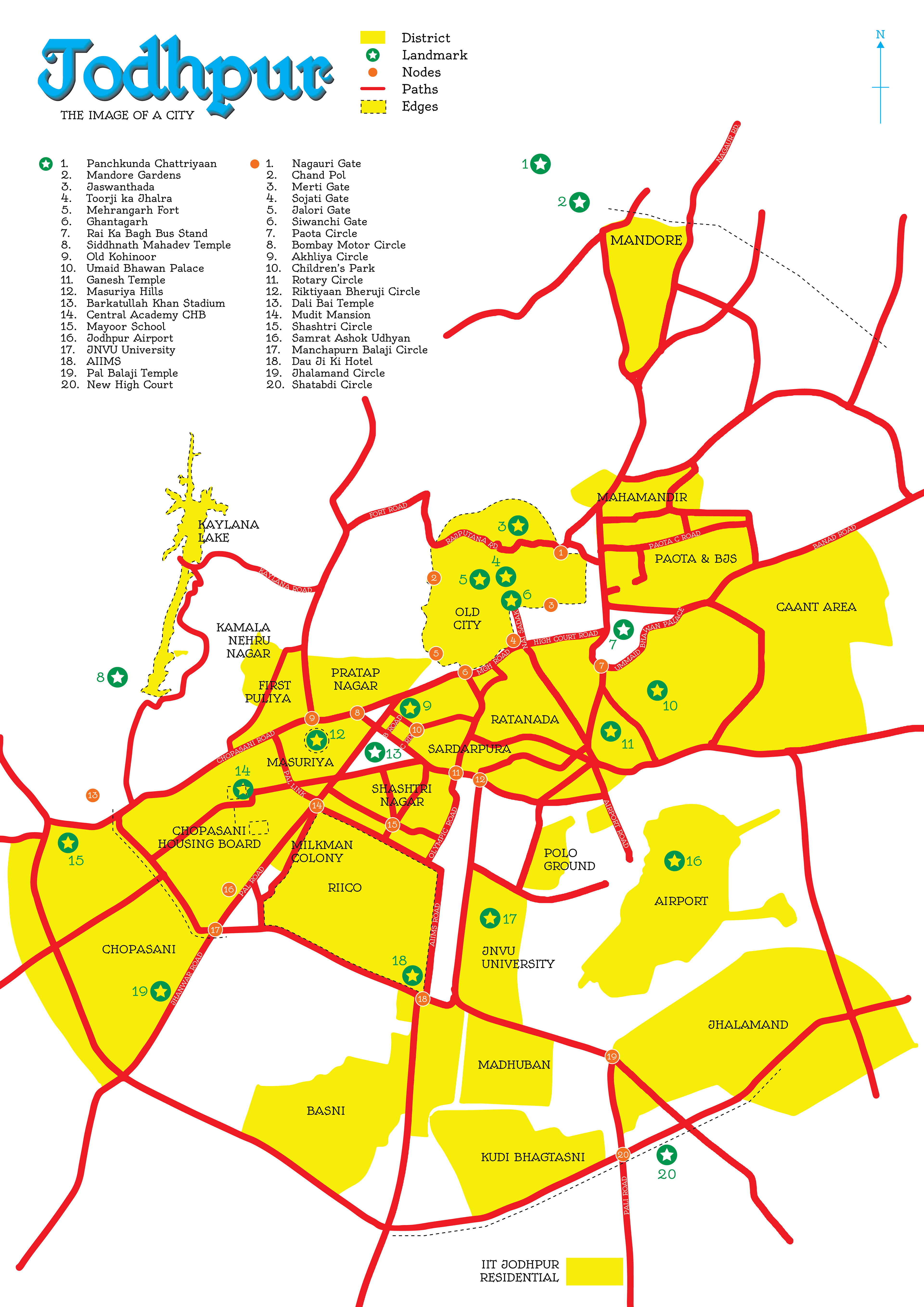
Out of 27 years of my life, I have spent more than 22 of them in Jodhpur. So, when assigned to create the 'Image of a City' I knew what I had to choose.
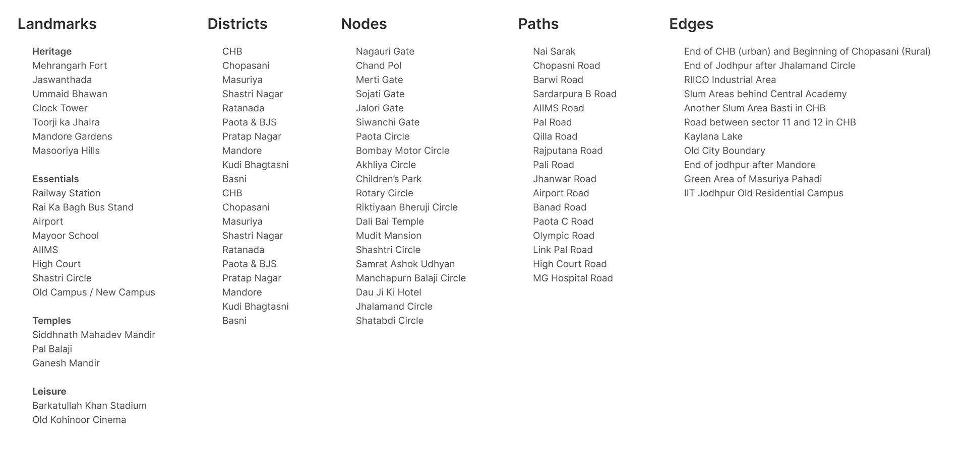
To create the 'Image' we had to use Kevin Lynch's model that breaks down a city in 5 elements; Districts, Landmarks, Nodes, Paths, and Edges. He describes them as follows:
Districts
• Medium to large areas that are two-dimensional
• An individual enters into and out of these areas
• Have common identifying characteristics
Landmarks
• Points of reference person cannot enter into
• These are buildings, signs, stores, mountains, public art
• At least one aspect of them is unique or memorable in the context they exist
Nodes
• Large areas you can enter, serve as the foci of the city, neighborhood, district, etc.
• Offers the person in them multiple perspectives of the other core elements
Paths
• These are the streets, sidewalks, trails, canals, railroads, and other channels in which people travel
• They arrange space and movement between space
Edges
• Boundaries; can be either Real or Perceived
• These are walls, buildings, shorelines, curbstone, streets, overpasses, etc.
Process
• Identify the five elements
• Making rough sketches
• Creating the final map
Five elements
Initial Thought Process and Color Palette
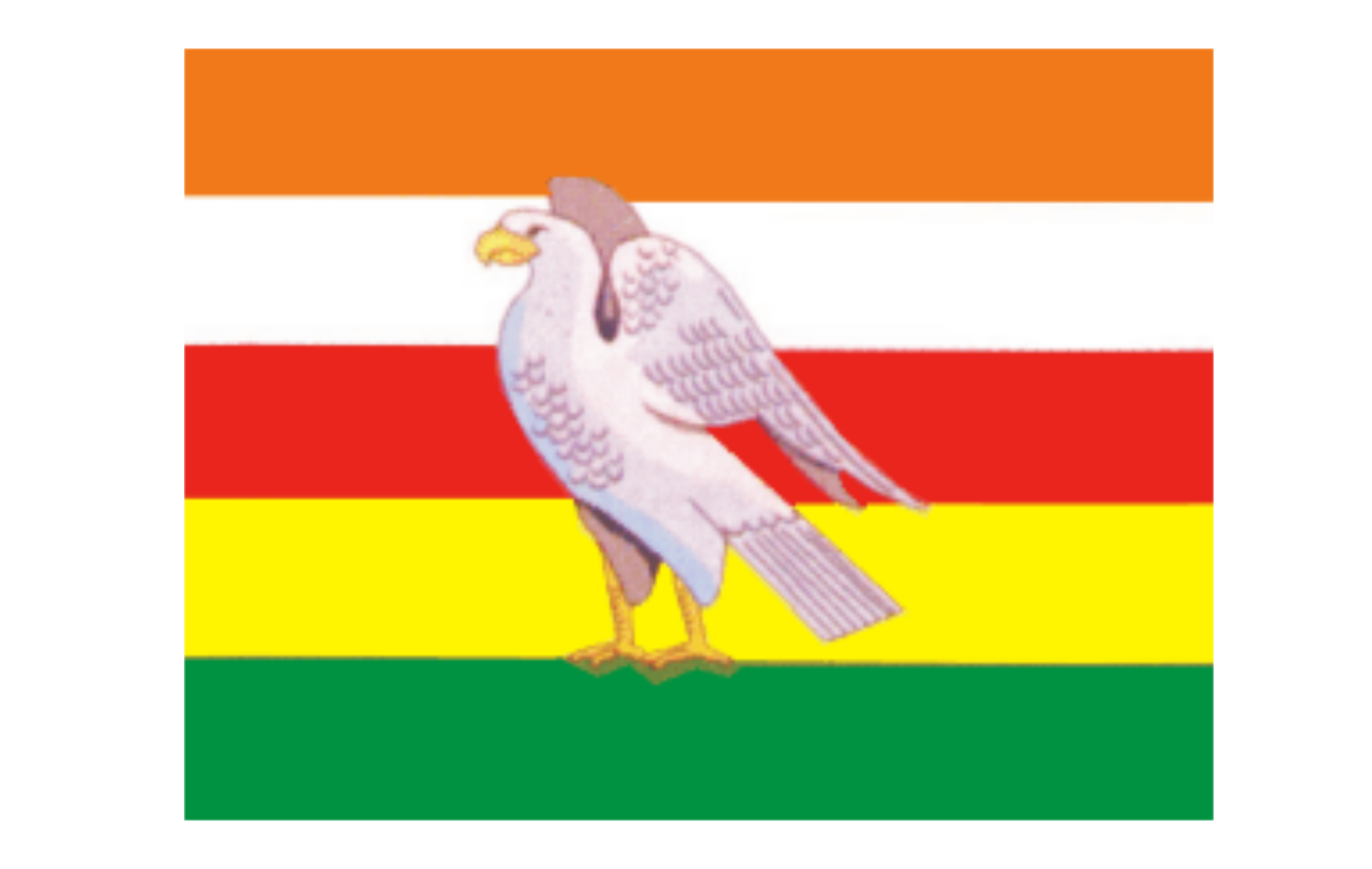
The State Flag of Marwar is called Pachranga which literally translates to Paanch Rang; five colors. The five-striped flag is overlayed with an Eagle; which was also the state emblem of the state of Jodhpur/Marwar during its Autocratic days.
Decided to use these 5 colors as the color scheme for the map.
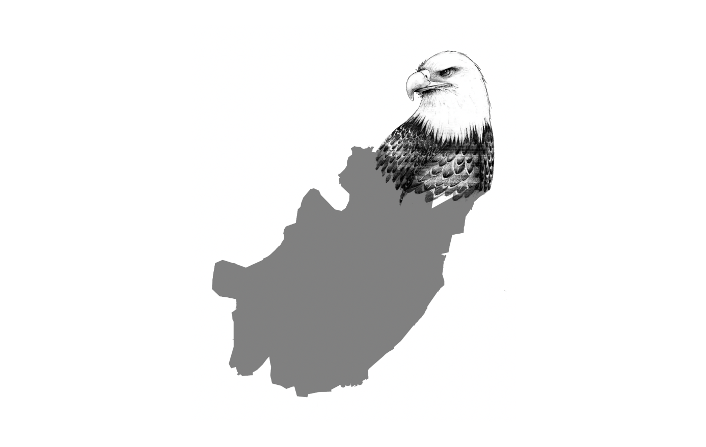
Taking a closer look at the google map of Jodhpur, it looks like the body of the eagle.
Rough Sketches
The map was first sketched in Procreate then different color patterns, textures, and font sizes were tried. Before finalizing A2 and A3 size prints were taken to see the legibility of the text.
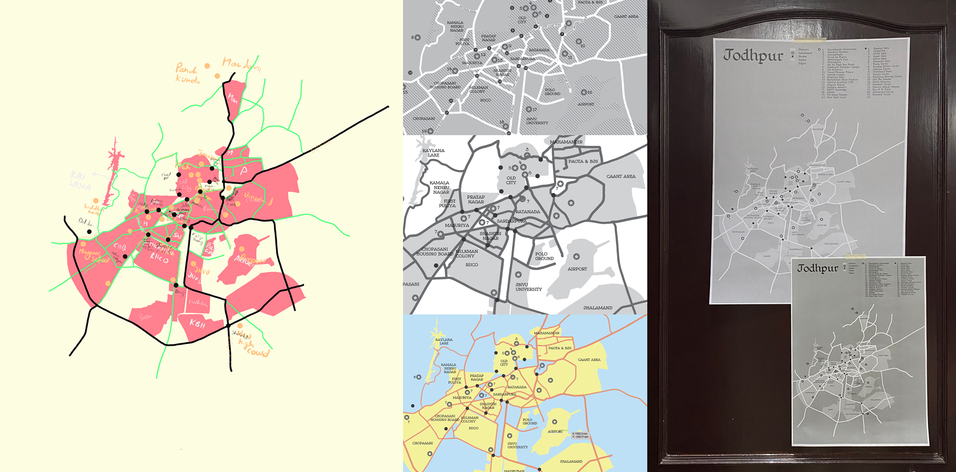
Final Map